
ABOUT THE RACE

The event known as DBB Mountain Rockstar Trail Run is part of MGM Trail Running Series. It features three race categories:
1. 12 Km race
2. 25 Km race
3. 50 km race (Utra Trail Mt. Batolusong)
Race Information:
Date: August 7, 2016
Starting/Finish Area: Barangay Hall of San Andres, Tanay Rizal
Start Time: 4:00AM (50km) / 5:00AM (25km) / 5:30AM (12km)
Cut Off Time : 12km (6hrs) / 25km (9hrs) / 50km (15hrs)
Race Map and Elevation Profile (scream hardcore!)


Trophies for Podium Finishers!

Finishers' Tokens- beautifully crafted medals and very useful cap and headware!


RACE REPORT
This is my 8th trail run with ultra distance (beyond 42km) and by far, the hardest mountain run for me.
The inclement weather, which made the trail muddy, slippery, and dangerous, was a major factor. Still, sans the rainy weather, the route itself is really difficult given that you have to summit 6 peaks! The first 25 km of the route requires climbing the 3 peaks of Mt. Batolusong, namely Rangyas peak, Susong Dalaga, and Radar. These 3 peaks were so wicked that I thought the second half could not be worse but I was wrong. A week before the race, I was injured from a road marathon so I thought of finishing just the first half of the race (meaning, climbing just Mt. Batolusong and going back to the starting line, which is also the end of 25Km course). My foot extensor and plantar worsens everytime I tackle the uphills because of the extra effort I had to exert to have a good grip so as not to slip in the muddy ascents of Batolusong.
After the last peak, i.e., radar, the last uphill was short and gradual followed by last 3km of downhill and flats going to the finish line of 25km course. The easier course helped reduce the pain in my extensor and plantar and when I reached the finish line, I decided to continue with the second half of the 50Km course (km 25-50).


Going back to starting line/KM 25 mark
Photo credits: Ken Agsaway

At the starting line/KM 25 mark
Photo credits: Jaja Ferrer
The first 5km of the second half of the course featured flats to mild uphill of wide fire roads, which gave me a feeling of optimism and confidence that I'll finish the whole course within the cutoff time. I was the last runner to leave km 25; the others behind me already DNF'd so I was alone in my journey from km 25-km 30.
Few kilometers after KM 30, I started to enter a single, muddy and slippery track of Mt. Natad, which means suffering again. The ascents were gradual but never ending. After a few ascents, the sweeper of 50km was able to catch up to me. Sweeper Kevin helped me picked up my pace- climbing Natad alone is exhausting and boring and that means more time wasted to rests and food breaks. It rained so hard while we were inside Natad but because of the forest covers we were not soaked from the rain. At the foot of Natad was another aid station, which also marked km 42 of the course. The marshal mentioned that there were no more uphills for the remaining 8km, just a manageable elevation and wide fireroad until the finish line. But I guess he was joking because just after around 1km of wide road, we were greeted by another aid station with marshals who instructed us to turn right to climb Mt. Cayabu and Mt. Maynoba. What???
Mt. Cayabu features a steep ascent with stair trails. After that seemingly endless ascend, we had to go down a bit to climb another equally steep mountain, Mt. Maynoba, which features two peaks – Peak 1 and the Summit. Huhuhu. Since I had no choice but to complete the course since I’m almost there, I just prayed hard and each line of the prayer I uttered helped me climb a step further. Dasal lang talaga, as per Tita Alma Moreno. After reaching the summit (highest peak of Mt. Maynoba), we had to pass through the rolling hills and this meant tackling minor yet exhausting uphills. You got to hate the word rolling after you finished 3 major climbs. After the rolling hills, you’ll go all the way down going back to MGM trail (the first major ascent of Batolusong before reaching Rangyas). This MGM trail is rather dangerous because of the muddy single track and portions where you have to use a rappel. After crossing a few streams, I reached the finish line beyond the cut-off but still I’m thankful to have finished this race in one piece. Other than my extensor and plantar, I felt no other injury – no cramps and blister despite the number of rivers we’re required to cross.
Congratulations to the organizers, DBB Delos Angeles and the entire members of the MGM Productions. With their route, you’ll not feel shortchanged! The registration fee is all worth it! The aid stations were also well-supplied – have the right to claim it because I was part of the last pack and when we reached the last aid stations, they still have hydration and food. The marshals are also very accommodating and motivating. If you want to experience hard core, you've got to try this UTMB Pinoy version!
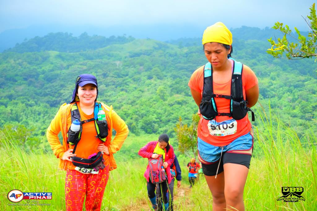

Climbing to Duhatan
Photo credits: Active Pinas

My finisher's medal ! So worth it!
for more info, go to: DBB Mountain Rockstar 2016 FB Events page. You may also check the FB page of MGM Productions of MGM Mountain Run for their future trail races. Sulit ang races nila! From the route to the aid stations to the finishers' tokens (medal, shirt, freebies). Well- marked ang race course so you don't have to worry about getting lost. XOXO
congrats!
ReplyDeletethank you, Sir! Galing ng mga marshals eh. Congrats din sa nuvali! Champion!
DeleteCongratulations Tin! 😊
ReplyDeleteThanks jose!!!
Delete